|
|
|
Wetlands
Search Comes Up Dry |
 |
|
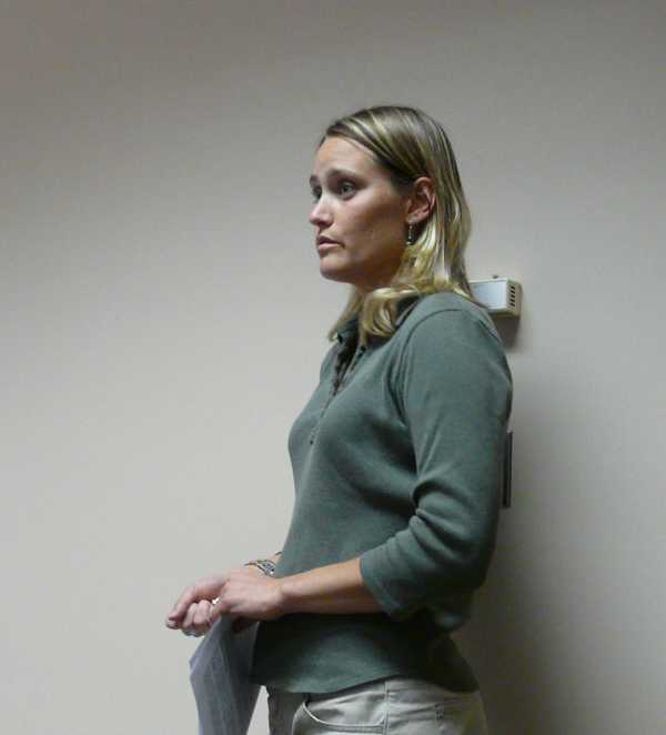
Lily Palmer representing Coleman Engineering
presents Phase 1 of the Wetlands Search to the
Gogebic Economic Development Commission. The
County has commissioned Coleman Engineering to
search for suitable wetlands that could be
placed into a County Wetlands Bank. The bank
would be used to make it easier for developers
to build in current restricted wetlands areas
primarily along U.S. 2.
According to the report the county-wide
search was conducted using GIS layers to sort
out the parcels. According Ms. Palmer
"Restoration of drained wetlands is the
preferred mitigation banking method." "the sites
revealed using the given GIS search parameters
did not result in any significant restoration
opportunities within Gogebic County." The
reports states that "The economic history of
Gogebic County is not rooted in agriculture,
therefore an effort at finding sites suitable
for restoration of drained farmland have turned
out to be largely unsuccessful."
Ms. Palmer told the EDC members that
"If the EDC was interested in pursuing a
restoration based wetland mitigation bank,
additional GIS site searches could be conducted
to examine 10 acre and smaller agricultural
lands. There may be smaller sites within the
County that may offer feasible restoration
opportunities. "
"Given that no suitable restoration sites were
found within the County during Phase I of the
project, an alternative is to attempt
construction of a wetland mitigation bank based
on creation of new wetlands. The created
wetlands option is much more costly than
traditional wetland restoration and would
require close consultation with the MDEO to
determine if it would even be a feasible to
pursue. This scenario may not be the most cost
effective for the EDC, particularly because
there is no scheduled return on the investment "
One of the alternatives still available is to
have the developers handle the mitigation
themselves. |
|
The Final
Report for Phase 1 is reported below |
Phase I Search for Potential Wetland Mitigation
Sites in Gogebic County, Michigan September 24,
2008
BACKGROUND
According to the Michigan Department of
Environmental Quality (MDEQ) Wetland Mitigation
Banking Handbook, wetland mitigation banking is
the creation or restoration of wetlands in order
to provide mitigation credits that can be used
to offset permitted wetland .Iosses. Mitigation
banking benefits wetland resources by providing
advance replacement for permitted wetland
losses, consolidating small projects into
larger, better-designed and managed units, and
encouraging integration of wetland mitigation
projects with watershed planning.
The ideal wetland mitigation bank will consist
of wetland restoration. This process involves
restoring formerly drained wetlands to their
natural state through various methods which may
include blocking existing drain tile or other
ditches. Restoration returns a site to
historical conditions and is typically less
costly and more successful than wetland
creation. Wetland creation means the physical
and biological establishment of a wetland where
a wetland did not formerly exist. Sites
requiring complex design and construction
strategy to achieve wetland functions should be
avoided, thus restoration of historic wetlands
should be the preferred banking method. Under
certain circumstances, limited mitigation credit
may be given for the preservation of existing
wetlands which have exceptional public values.
Using preservation of existing wetlands for
mitigation, however results in an overall loss
of wetlands. Therefore, mitigation credit is not
typically offered for preservation of existing
wetlands. In those situations where mitigation
banks include preservation credits the wetlands
must meet specific criteria. These criteria
include exceptional physical or biological
function essential to the preservation of the
natural resources of the state or that the
wetland is of an ecological type which is rare
or endangered. In addition, the preserved
wetland must be under threat of loss or
degradation due to human activities and the
preserved wetland must be protected by inclusion
in the bank with specifications for management
measures to protect its exceptional wetland
functions. No more than 15 percent of the total
wetland acreage in a mitigation bank may be
preserved wetlands.
In addition, a wetland mitigation bank should be
constructed with the overall intent of replacing
those wetland functions which are unavoidably
lost as a result of permitted activities within
that watershed. Thus, the site should be
situated in the watershed where wetland impact
is likely to occur. The Gogebic County Economic
Development Commission (EDC) has identified the
U.S. Highway 2 corridor between the cities of
Bessemer and Ironwood as a possible commercial
development area where existing wetlands are
seen as a hindrance to development. Attachment 5
shows the National Wetlands Inventory (NWI)
overlay for the US Highway 2 corridor from
Ironwood to Bessemer. The NWI map shows the
potential wetland acreage along this corridor to
be roughly 224 acres.
The U.S. Highway 2 corridor between Bessemer and
Ironwood is comprised of the Montreal River
watershed to the west and the Black River
watershed to the east . Therefore, potential
mitigation sites located within these watersheds
should be prioritized. Again, mitigation banks
should be designed to replace wetlands lost
within the same watershed. Nearly all of the
sites produced by GIS sorting during Phase I of
this project are located within these
watersheds. The watershed name is listed on each
individual site data sheet. |
GIS SITE SEARCH DESCRIPTION
Site search for a wetland mitigation bank was
conducted within the boundaries of Gogebic
County, Michigan.
Numerous site searches were conducted using
Geographic Information System (GIS) layers to
sort out possible mitigation sites. The site
searches were implemented to locate 10-acre
sites and 20-acre and greater potential wetland
mitigation sites. The flow chart criteria
utilized to determine these sites are included
in Attachment 1.
The individual site searches are summarized in
Table 1, below.
| ACREAGE |
WOODED
(Acres) |
OPEN LAND
(farmand & other) (Acres) |
TOTALS |
10 Acre & Greater
County Lands |
174 |
15 |
189 |
10 Acre & Greater - All
Inclusive Lands |
5082 |
1773 |
6855 |
20 Acre & greater - All
Inclusive Lands |
Included in
10 acre search |
428 |
428 |
| |
|
|
7472 |
In considering a wetland mitigation bank in
Gogebic County, setbacks from local airports
must be considered. The FAA recommends a
setback distance of 10,000 feet for hazardous
wildlife attractants including wetland
mitigation banks. The Federal Aviation
Administration (FAA), the U.S. Air Force, The
U.S. Army Corps of Engineers, the U. S.
Environmental Protection Agency, The U.S. Fish
and Wildlife Service, and the U.S. Department of
Agricultural - Wildlife Services signed a
Memorandum of Agreement in July 2003 to
acknowledge their respective missions in
protecting aviation from wildlife hazards. The
FAA provided an Advisory Circular in August 2007
outlining specific setback requirements at
airport facilities. The FAA requires that
wetland mitigation projects that may attract
hazardous wildlife (i.e. waterfowl, migratory
birds, etc) be sited outside of the minimum
separation criteria for the airport facility.
The FAA criteria include land uses that cause
movement of hazardous wildlife onto, into, or
across the airport's approach or departure
airspace or air operations area. The separation
distances are based upon 1) aircraft flight
patterns, 2) the altitude at which most strikes
happen (78% occur under 1,000 feet and 90% occur
under 3,000 feet above ground level) and 3)
National Transportation Safety Board
recommendations. For airports that serve turbine
powered aircraft (such as Gogebic County
Airport) the FAA requires a separation distance
of 10,000 feet for any wetland mitigation site
development. This separation distance for the
Gogebic County Airport is shown in Figure 1 in
Attachment 4. No sites within 10,000 feet of the
airport were included in this report.
The 10-acre all inclusive (County and privately
owned) agricultural and wooded lands GIS search
resulted in 6,800 acres of land. To facilitate
ground-truthing of individual sites and in
keeping with the EDC's request, this massive
acreage was trimmed down by narrowing the search
to include only 10-acre County lands as the EDC
had expressed that County owned lands are the
desired location for a wetland mitigation bank.
The 10-acre County owned lands with agricultural
or wooded coverage turned up 13 sites
·encompassing 189 acres; 174 of these acres are
wooded. Three sites comprising 43.5-acres (Sites
412, 414 and 415) were not accessible by
vehicle. A fourth site of 20.5-acres (Site 280),
lying immediately north of Extreme Tool in
Wakefield Township was deemed likely be in
conflict with the mission of this industrial
park area nor was it accessible by vehicle, and,
therefore, was not ground-truthed. Thus, the
remaining 9 sites (125-acres) of County owned
land were ground-truthed. A County-wide map
showing individual site locations is included.
The individual site specific data sheets are
included.
The 20-acre and greater site search (County and
privately owned) agricultural lands search
resulted in 428 acres comprising 15 sites. All
of this acreage was on private land (any County
owned lands occurred within 10,000 feet of the
Gogebic County Airport and were, by rule,
eliminated). One 24-acre parcel (Site 1) was not
accessible by vehicle. Thus, the remaining
404-acres of privately owned property (14 sites)
were ground-truthed. Again a County-wide map
showing individual site locations is included.
The individual site specific data sheets are
included.
|
FIELD CHECK OF GIS SITE SEARCH RESULTS
Field checking of the sites produced from the
GIS searches described above was conducted in
August and September, 2008. A brief description
of the results of the field investigations in
Gogebic County are provided in this section. The
data sheets for each individual site are
included in Attachment 3 and they provide
additional data concerning the sites. One field
team was deployed to check the sites identified
in the site search. A standard methodology of
site review and data gathering were utilized
with the intent of attaining consistency in how
sites were evaluated.
As described above, in the 10-acre County land
category a total of 9 sites were field checked.
All of the sites were mostly wooded. None of the
sites appeared to be candidates for wetland
restoration as they did not appear to have been
disturbed by humans or by human-made drainage
structures, however some of the sites. may be
candidates for wetland creation in a more
conventional sense, as described in the Summary
of Findings section, below. Typically, the MDEO
prefers wetland mitigation banks be formed from
restoration of historically drained or altered
open, agricultural lands as opposed to through
the harvesting of forestlands.
The 14 sites identified in the 20-acre and
greater privately owned lands categories were
groundtruthed. Unfortunately none of these
sites appeared to be restorable wetland sites,
however the sites with the most potential for
wetland creation are described as follows:
Site 394 - This site is located near Saari Lane
and Airport Road, north of the City of Ironwood.
The western half of the site is an active horse
pasture and the southwestern area may already be
wetland, exhibiting that hydrology is near the
ground surface. The possibility exists to expand
the existing wetland area to the east by
excavating the surrounding slopes.
Site 230 -This site is located northwest of the
intersection of Pioneer Road and Van Buskirk
Road, south of the City of Ironwood. The
existing swale on the east side of the property
is tied into regional drainage and blocking it
may negatively affect neighboring properties.
The center of the site is relatively high, thus
the most feasible creation possibility lies
around creating wetland hydrology around the
perimeter of the site's high center. Significant
earthwork would need to be undertaken to remove
the site's high center and increase wetland
creation acreage.
386 - This site is located north of the
intersection of Airport and Norlund Roads. There
may be some possibility to create a wetland by
constructing a berm across the existing natural
drainage through center of western portion of
the farm field. There also appear to be ditches
in the upland pastures immediately at the
termination of the north end of Saari Lane.
|
SUMMARY OF FINDINGS
Restoration of drained wetlands is the preferred
mitigation banking method. In summary, the sites
revealed using the given GIS search parameters
did not result in any significant restoration
opportunities within Gogebic County. The
economic history of Gogebic County is not rooted
in agriculture, therefore an effort at finding
sites suitable for restoration of drained
farmland have turned out to be largely
unsuccessful. If the EDC was interested in
pursuing a restoration based wetland mitigation
bank, additional GIS site searches could be
conducted to examine 10 acre and smaller
agricultural lands. There may be smaller sites
within the County that may offer feasible
restoration opportunities.
Given that no suitable restoration sites were
found within the County during Phase I of the
project, an alternative is to attempt
construction of a wetland mitigation bank based
on creation of new wetlands. The created
wetlands option is much more costly than
traditional wetland restoration and would
require close consultation with the MDEO to
determine if it would even be a feasible to
pursue. This scenario may not be the most cost
effective for the EDC, particularly because
there is no scheduled return on the investment
Perhaps the most viable option for the EDC to
consider would be utilizing the data gathered
from Phase I of this process to provide
potential developers with a "bank" or
"selection" of upland sites on County' lands
that could be developed into wetlands on an
as-needed basis (this is more in line with
"conventional" mitigation conducted on a
site-by-site basis). Sufficient onsite work
would need to be conducted on the high priority
sites to ensure that they are feasible for
creation of wetlands. This scenario would
release the EDC from the financial burden of
locating, creating and maintaining a wetland
mitigation bank while still providing possible
mitigation sites that developers could choose
from to create wetlands to mitigate for
permitted losses, at their own cost. In this
scenario the EDC's focus would now shift towards
locating sites suitable for wetland creation,
likely on County owned lands. Timber harvest and
sale or lease of the property to a developer
could possibly offset costs incurred during this
type of mitigation site selection process.
While this "bank" or "selection" of suitable
mitigation sites approach is certainly less of a
risk for the EDC, it would need to be balanced
with the overall goals of the Commission. Under
these circumstances, the developer would be
provided with a suitable mitigation site on
which to create wetlands at his/her cost, not a
wetland mitigation bank where he/she could "cut
a check" to mitigate for permitted wetland
losses and then walk away.
Resources
MDEQ Wetland Mitigation Banking Handbook,
September 2001.
Coleman Engineering Company CECJob No. 08050 EDC
- Final Report |
|
|
|
IronwoodInfo.com is a Michigan,
Non-Profit Media Corporation |
|
Contact IronwoodInfo.com |
|
email:
mail@ironwoodinfo.com
snail mail: P.O. Box 305 Ironwood, MI 49938
Telephone
Ironwood: 906-932-1402
Ontonagon: 906-885-5683
Fax
906-884-2544 |
| |
|
|